|

Salmon and the East Kitsap Region
| |
For more information about salmon recovery
planning in this watershed, visit:
http://www.kitsapgov.com/nr/
http://www.kitsapgov.com/boards/
Click here to
read this watershed's feedback summary.
|
 |
 |
|
|
|
Key
Facts |
| |
East Kitsap is 89% privately-owned.
Land type is 53% forest; 33% water (primarily marine);
8% urban; 3% agriculture and 3% other.
Major cities in East Kitsap include Bremerton, Gig
Harbor, Port Orchard, Poulsbo, and Bainbridge Island.
East Kitsap’s population is expected to grow
by 54 percent between 2000 and 2020.
The planning area for the watershed under the state
Watershed Management Act is Watershed Resource Inventory
Area (WRIA) 15.
|
|
| |
|
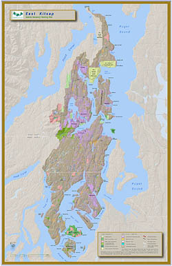
Kitsap’s sinuous shorelines form Key Peninsula, Gig Harbor
Peninsula, the South Puget Sound Islands including Anderson, Fox
and McNeil Islands, and Bainbridge Island. East Kitsap also harbors
countless small streams that empty into the marine waters of Puget
Sound along the eastern flank of the Kitsap Peninsula. Quiet and
easy-paced compared to the cities of Tacoma and Seattle less than
20 nautical miles away, small-scale and hobby farms still dot the
landscape in Kitsap, helping to maintain the area’s rural heritage.
The Kitsap Peninsula is 400 square miles in size, surrounded by 360 miles of
saltwater shoreline. Because water access was the only way early settlers could
reach the Peninsula, nearly every community in Kitsap has a water view, marina
or stretch of beach to enjoy.
East Kitsap’s shorelines account for nearly half of the nearshore
habitat in south and central Puget Sound and provide vital habitat
for threatened chinook and bull trout populations from watersheds
throughout those areas. Nearshore habitat provides refuge, resting
and feeding grounds for juveniles heading out to the ocean and to
adults returning to spawn.
Major Policy or Actions Needed to Recover
Salmon
East Kitsap is second to the San Juan Islands for total length of marine nearshore.
Marine intertidal, nearshore, and sub-tidal areas provide critical habitat
for salmon, particularly for juvenile smolts as they migrate from freshwater
systems in south and central Puget Sound watersheds to the ocean. Shallow
nearshore areas are known to provide rearing habitat and shallow-water migration
corridors that offer protection from predators. Two assessments (the draft
Bainbridge Island Nearshore Assessment and the 2003 Key Peninsula, Gig Harbor
and Islands Watershed Nearshore Salmon Habitat Assessment) have methodologies
in place to prioritize nearshore habitat for protection and restoration in
their respective areas.
Due to low gradients, an abundance of wetlands and relatively limited development,
East Kitsap’s 125 identified streams harbor a rich potential to support
salmon enhancement efforts using local brood stocks. The Suquamish Tribe’s
Hatchery programs are aimed at maintaining treaty fishing rights and easing
pressure on wild salmon populations, including wild runs of chum salmon on
Chico Creek, East Kitsap’s most intact and naturally productive stream.
East Kitsap has a strong history of building partnerships to forge collaborative
solutions on a variety of natural resource issues such as stormwater management
as well as numerous salmon habitat protection and restoration projects. To
contribute to the recovery of threatened chinook, policy decision-makers must
continue to build bridges with private property rights advocates, provide landowner
incentives for habitat protection and restoration on private lands (especially
related to shorelines), and continuously search for solutions that balance
the needs of both fish and people.
| We’re
Making Progress—Some Accomplishments |
Innovative Growth Management
The Chico Watershed Planning Project in 2002 created an
innovative process among local landowners and citizens,
local, state and federal government representatives
and Tribes to develop a preferred scenario for future
development in the Chico Creek Watershed. Importantly,
the preferred scenario can be directly linked to broader
planning under the state Growth Management Act. Kitsap
County intends to replicate the collaborative Chico
Creek Watershed process in other watersheds in the
County.
Strategic Approach to Address Fish Barriers
Culverts, screens and other mostly human-made barriers
to spawning and rearing grounds are a leading cause of
salmon declines in East Kitsap. Recovery efforts prioritize
fish passage restoration actions in streams identified
as having the most high-quality habitat and productive
capacity. Kitsap Conservation District will soon complete
an inventory of privately-owned passage barriers.
Gorst
Creek Restoration
To support a hatchery project on Gorst aimed at easing
fishing pressure on wild salmon, the City of Bremerton’s
Gorst Creek Restoration Project replaced a 750-foot segment
of concrete channel with 1000 feet of a meandering streambed
that replicates a more natural stream system. The project
also placed gravel, large woody debris and native plantings
along 1.5 miles of stream. A related SRFB project is restoring
1,200 feet of shoreline, adding 23, 271 square feet of
intertidal area, 2.5 acres of estuary of the Sinclair Inlet
to a “vintage 1942” natural wetland/estuarine
condition intended to benefit salmon and wildlife.
|
|
Organizations Involved
- City of Bainbridge Island
- Chums of Barker Creek
- Great Peninsula Conservancy
- Kitsap County Conservation District
- Kitsap County Health District
- Kitsap Public Utility District
- Kitsap County Natural Resource Conservation Service
- Kitsap County Solid Waste Division
- Kitsap County Surface & Stormwater Management
- Kitsap Peninsula Watershed Planning
- Poulsbo Marine Science Center
- Suquamish Tribe
- University of Washington Sea Grant Program
- Washington State Department of Fish & Wildlife
- Washington State Puget Sound Water Quality Action Team
- Washington State University Cooperative Extension
- West Sound Conservation Council
- Pierce County Water Programs
Back to Top | Back
to Watershed Profiles
|

